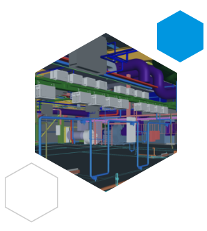
On refurbishment and upgrade projects, LIDAR 3D scanning enables us to develop virtual base-models of existing facilities and systems, where BIM files are unavailable.
We create accurate 3D Models from site surveys, using LIDAR scanners, which produce point cloud data that can be processed and integrated into Revit & Navisworks BIM models.
The ‘As Current’ models we produce using this method are then used as the base-line model for the production of designs, for upgrade projects and the replacement of plant & services.